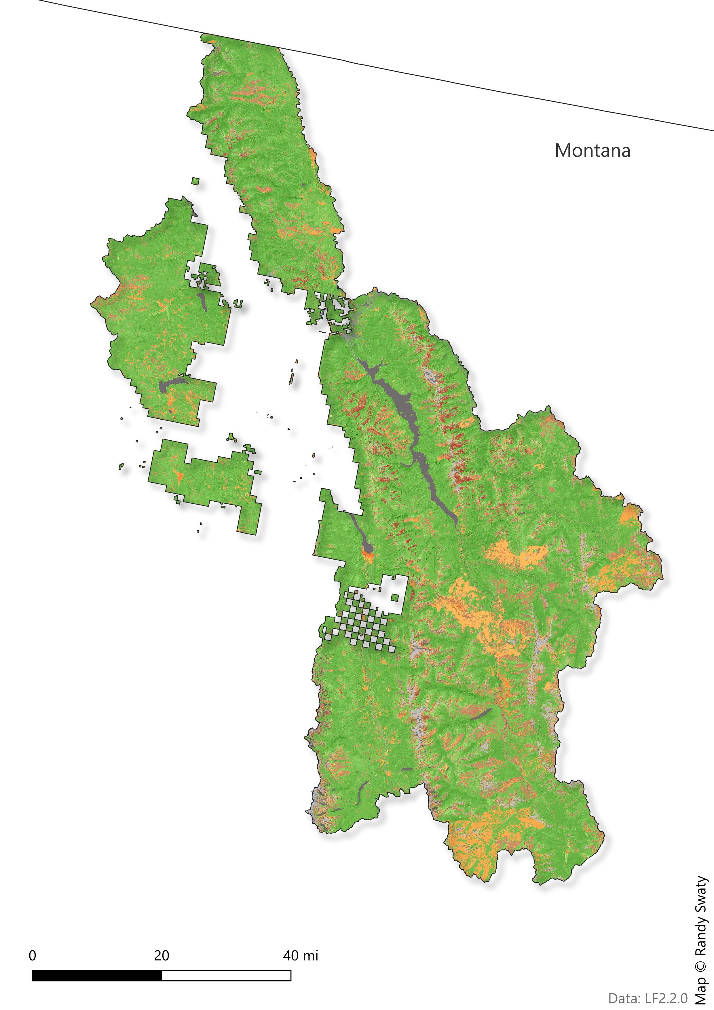
Present: Current Ecosystem Conditions
LANDFIRE’s Existing Vegetation Type, Cover and Height datasets describe vegetation conditions.
- Existing Vegetation Type (EVT) - represents the current distribution of the terrestrial ecological systems classification, developed by NatureServe for the western hemisphere, through 2020.
- Existing Vegetation Cover (EVC) - represents the vertically projected percent cover of the live canopy layer for a 30-m cell as of 2022.
- Existing Vegetation Height (EVH) - represents the average height of the dominant vegetation for a 30-m cell as of 2022.
Read more about LANDFIRE Vegetation Products
Summary
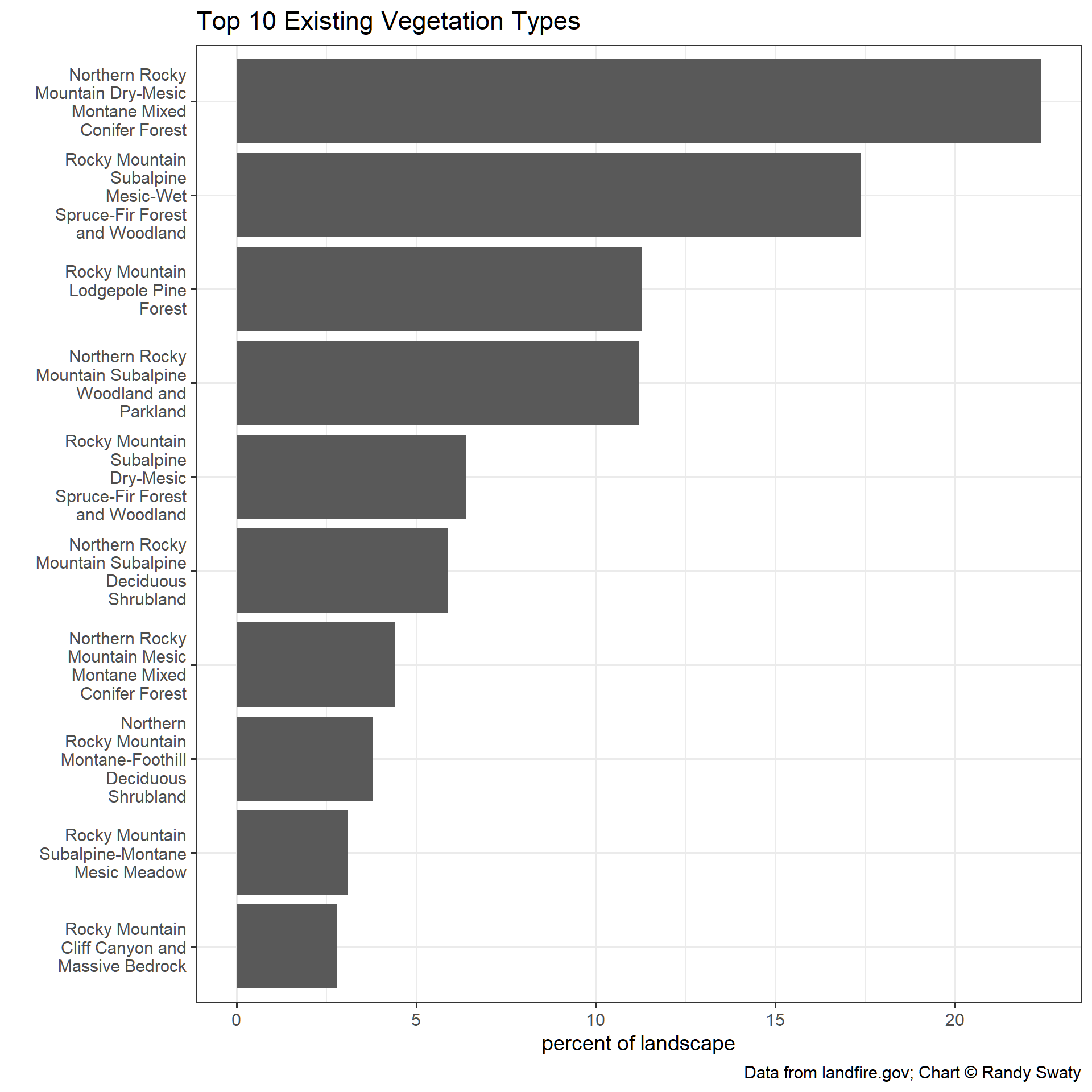
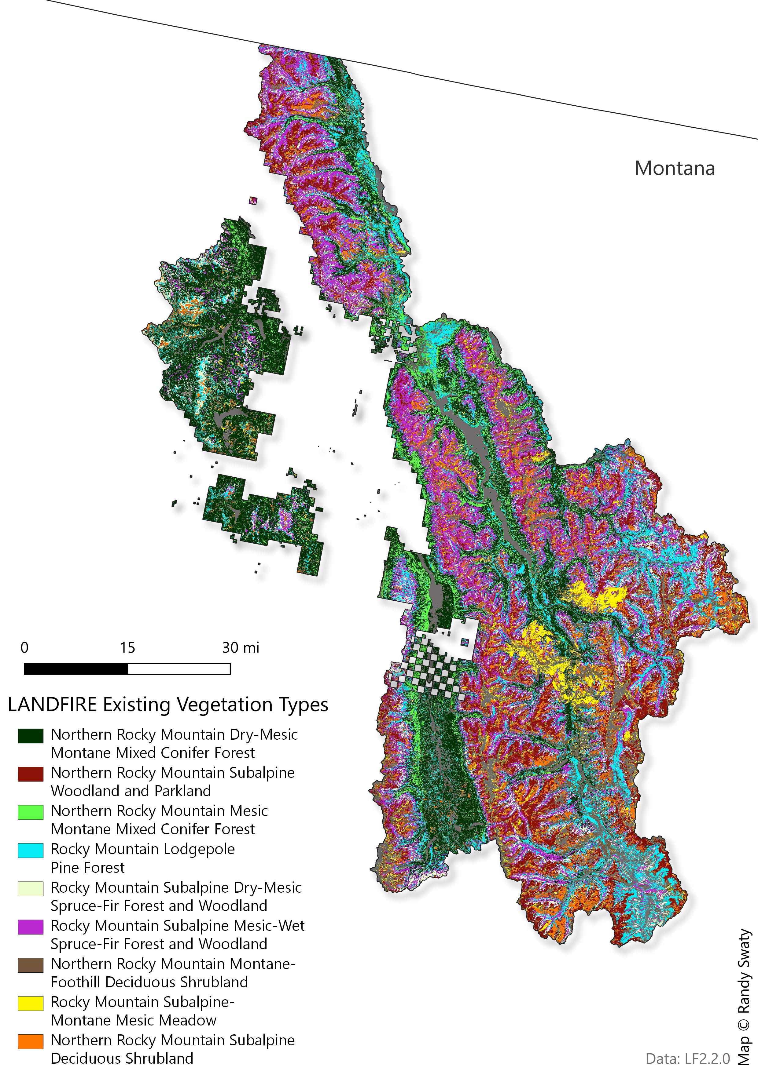
- Northern Rocky Mountain Dry-Mesic Montane Mixed Conifer Forest is mapped as the most prevalent in the Existing Vegetation Type dataset.
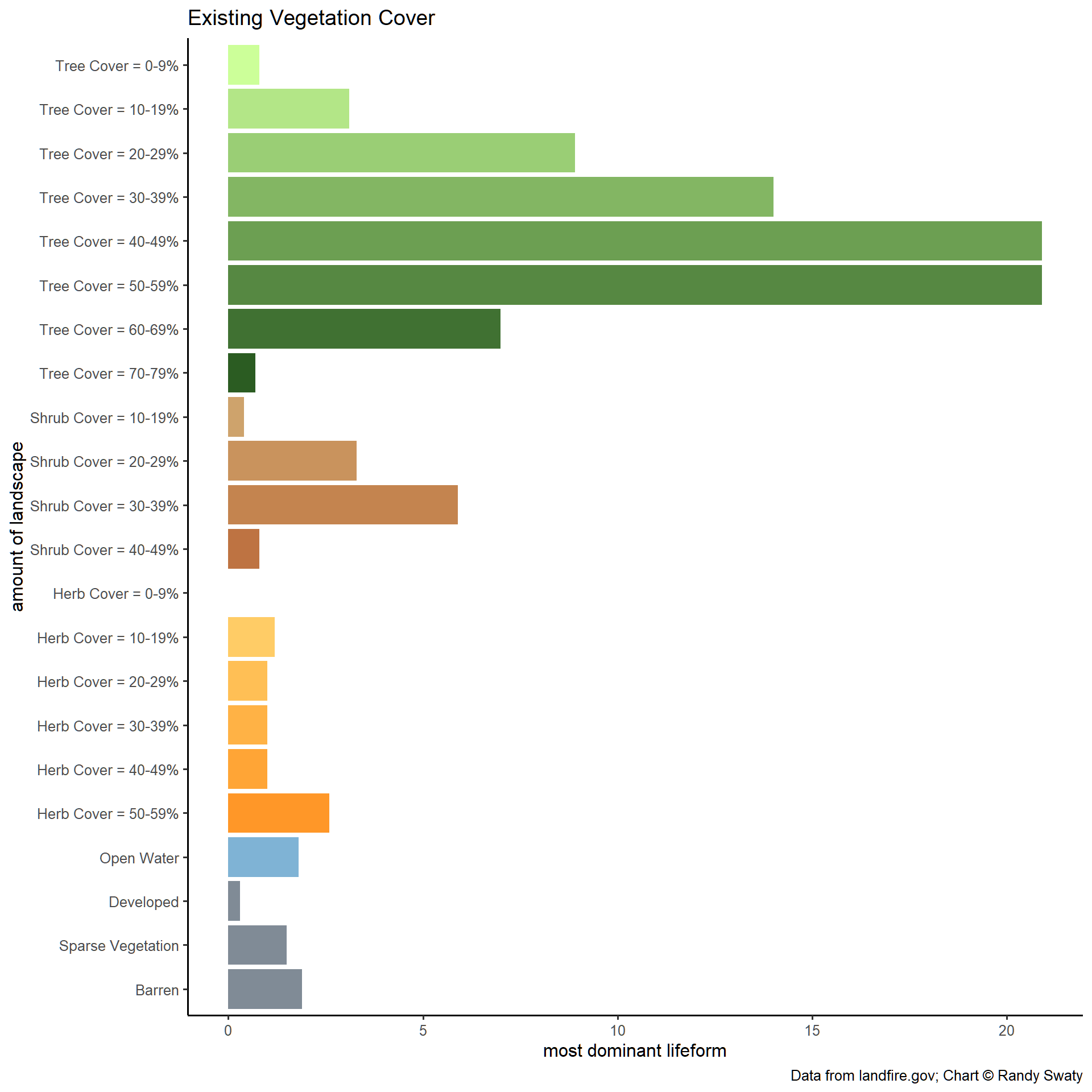
- Most vegetation is trees, with a roughly bell shaped curve of canopy cover estimates.
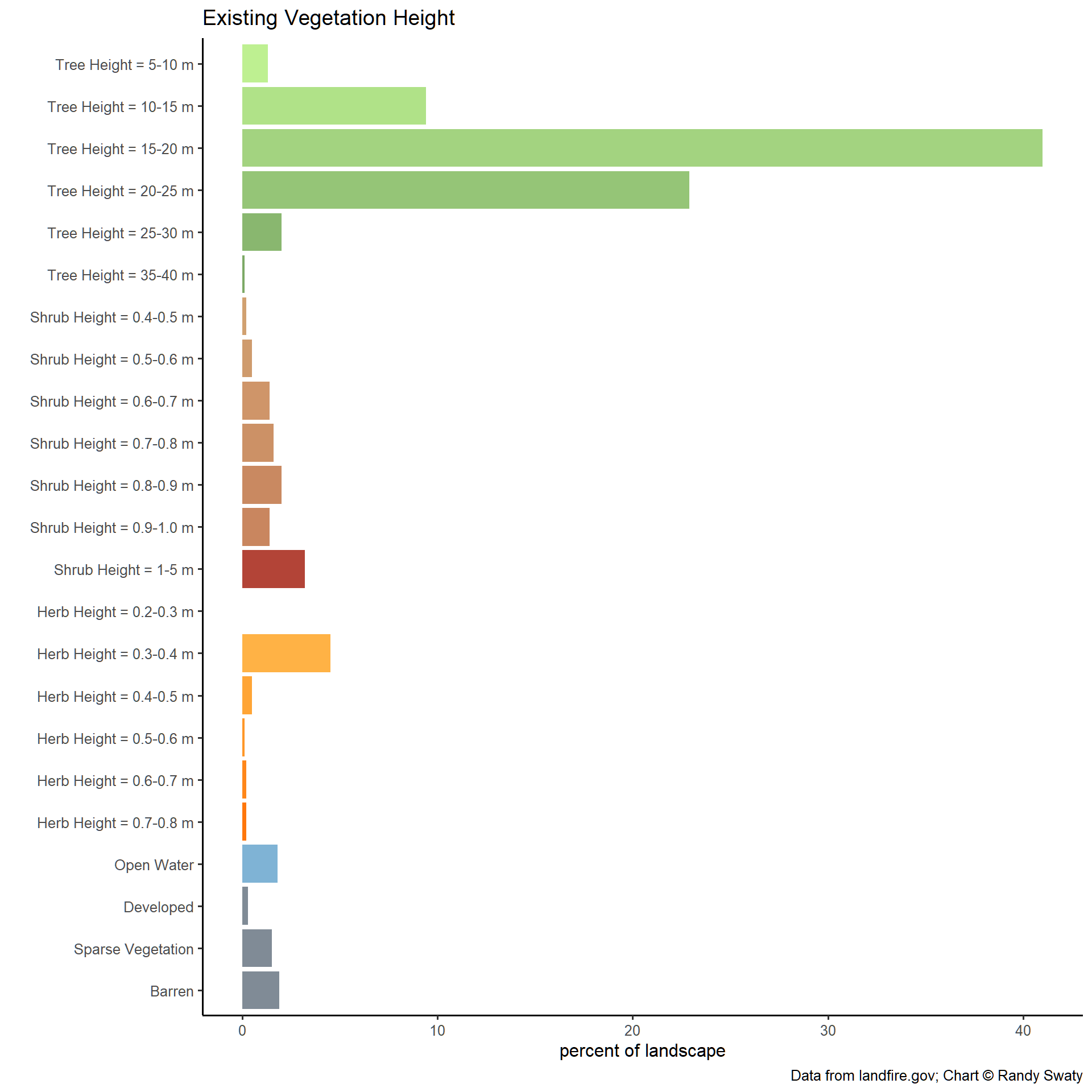
- Trees 15-20m are the most common in the Existing Vegetation Height dataset.
Most Prevalent Existing Vegetation Types
Most Prevalent Existing Vegetation Types
Existing Vegetation Cover
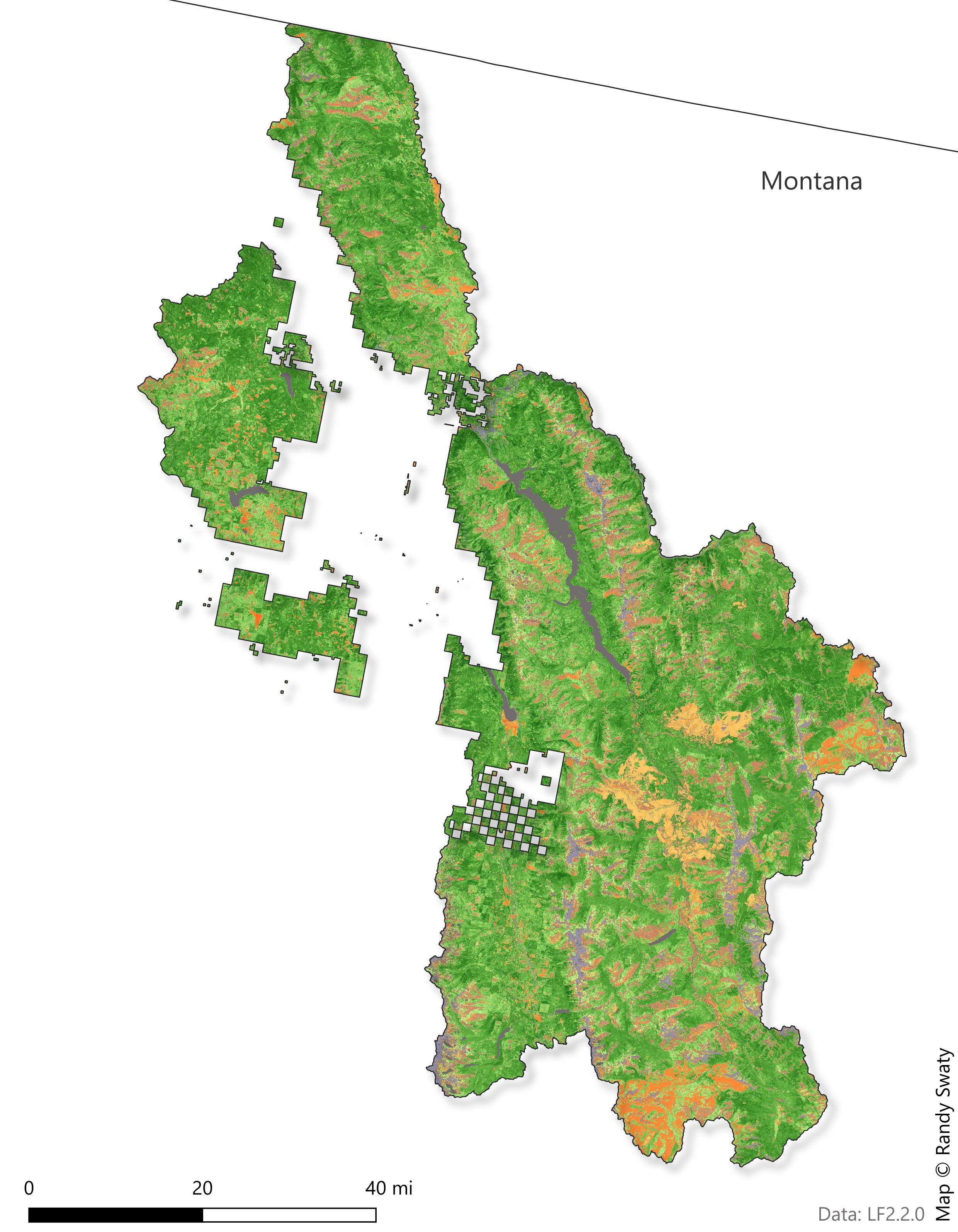
The Existing Vegetation Cover (EVC) map is a visual representation of EVC classifications across the subregion. The chart below the map provides a breakdown of each vegetation cover classification and their relative dominance across the subregion
From this information, we can see that the majority of this subregion is classified as “tree,” comprising approximately 70% of the vegetation cover.
Existing Vegetation Height
The Existing Vegetation Height (EVH) map showcases EVH across the subregion. The chart below the map provides the percentage of the landscape represented by each EVH height.
LANDFIRE maps trees as the most dominant life form, with most being between 10 - 20m tall.