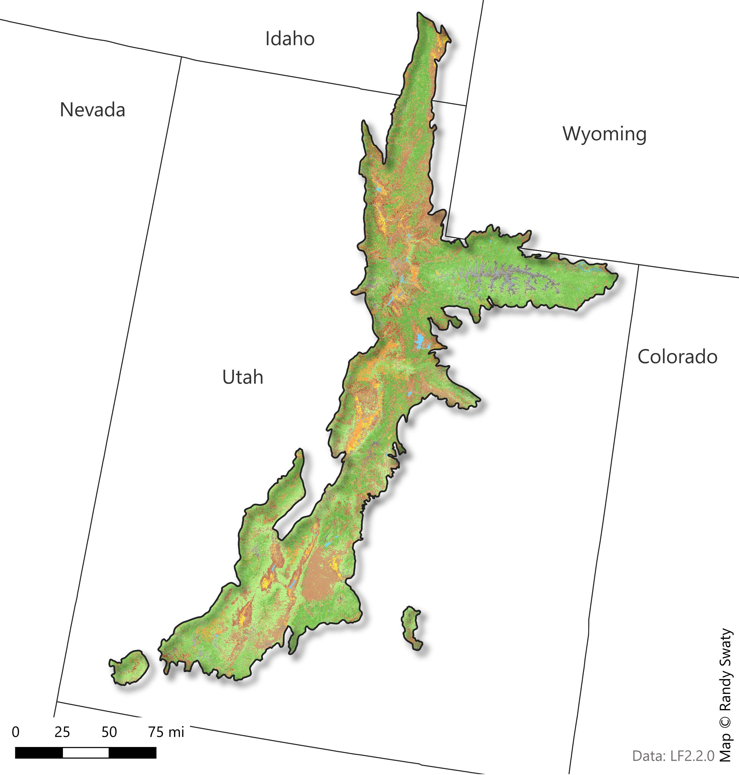
Present: Current Ecosystem Conditions
LANDFIRE’s Existing Vegetation Type, Cover and Height datasets describe vegetation conditions.
- Existing Vegetation Type (EVT) - represents the current distribution of the terrestrial ecological systems classification, developed by NatureServe for the western hemisphere, through 2020
- Existing Vegetation Cover (EVC) - represents the vertically projected percent cover of the live canopy layer for a 30-m cell
- Existing Vegetation Height (EVH) - represents the average height of the dominant vegetation for a 30-m cell
Read more about LANDFIRE Vegetation Products
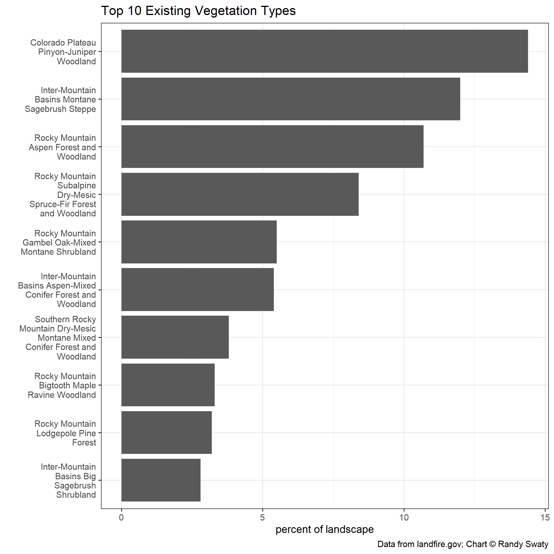
Summary
- The Colorado Plateau Pinyon-Juniper Woodland is the most prevalent ecosystem mapped on the landscape today at ~15%.
- No converted land uses (i.e., agriculture or developed) are represented in the top 10 EVTs.
- Most shrubs and tree vegetation have relativity low canopy cover (i.e., 10 - 50%).
Most Prevalent Existing Vegetation Types
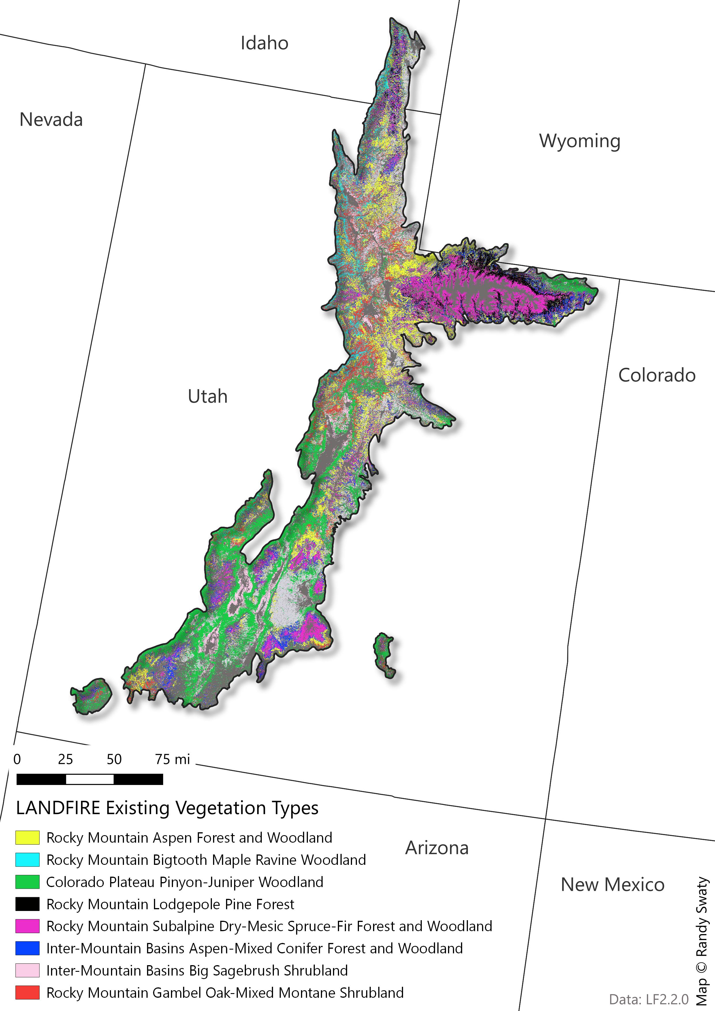
Most Prevalent Existing Vegetation Types
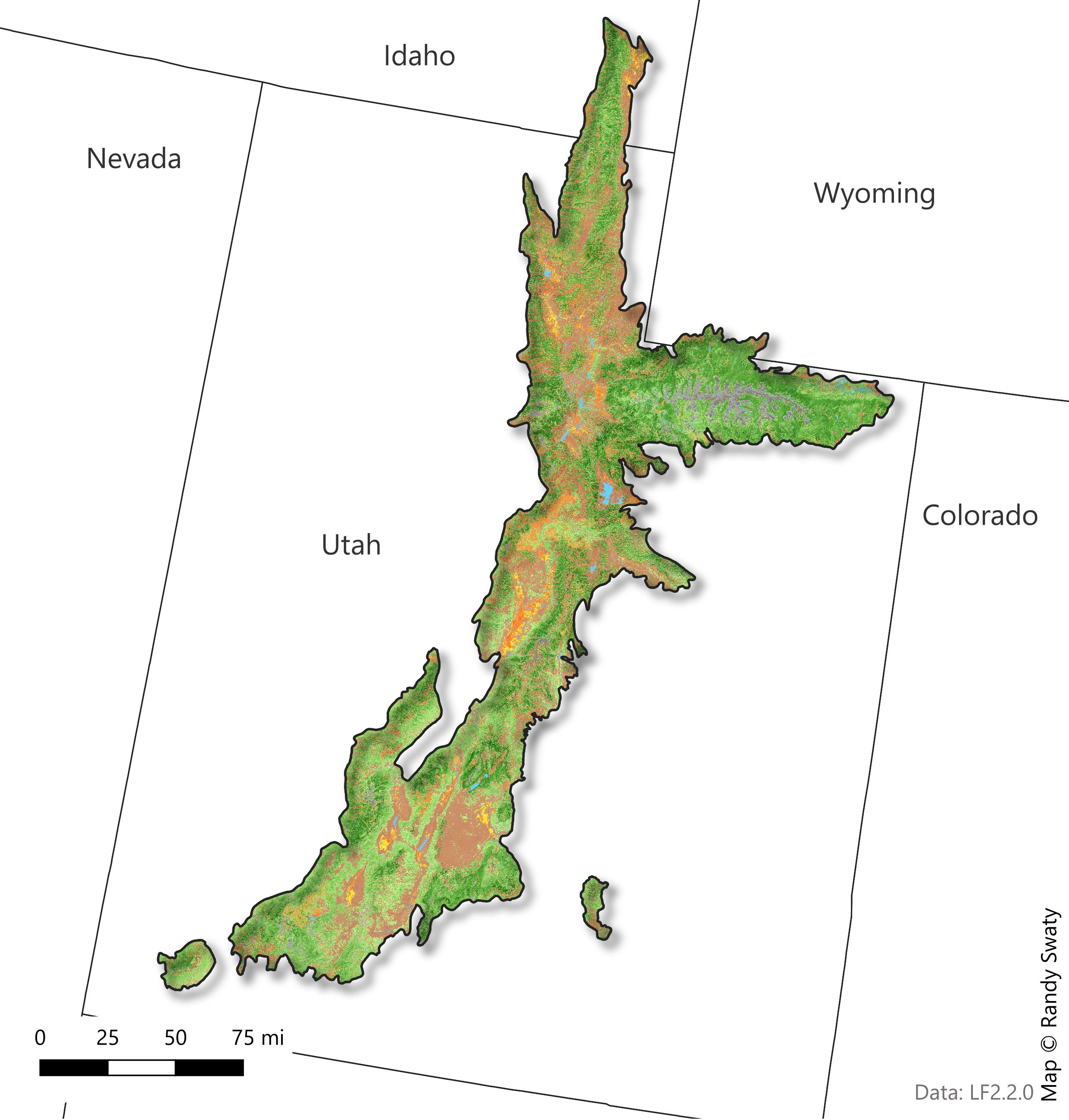
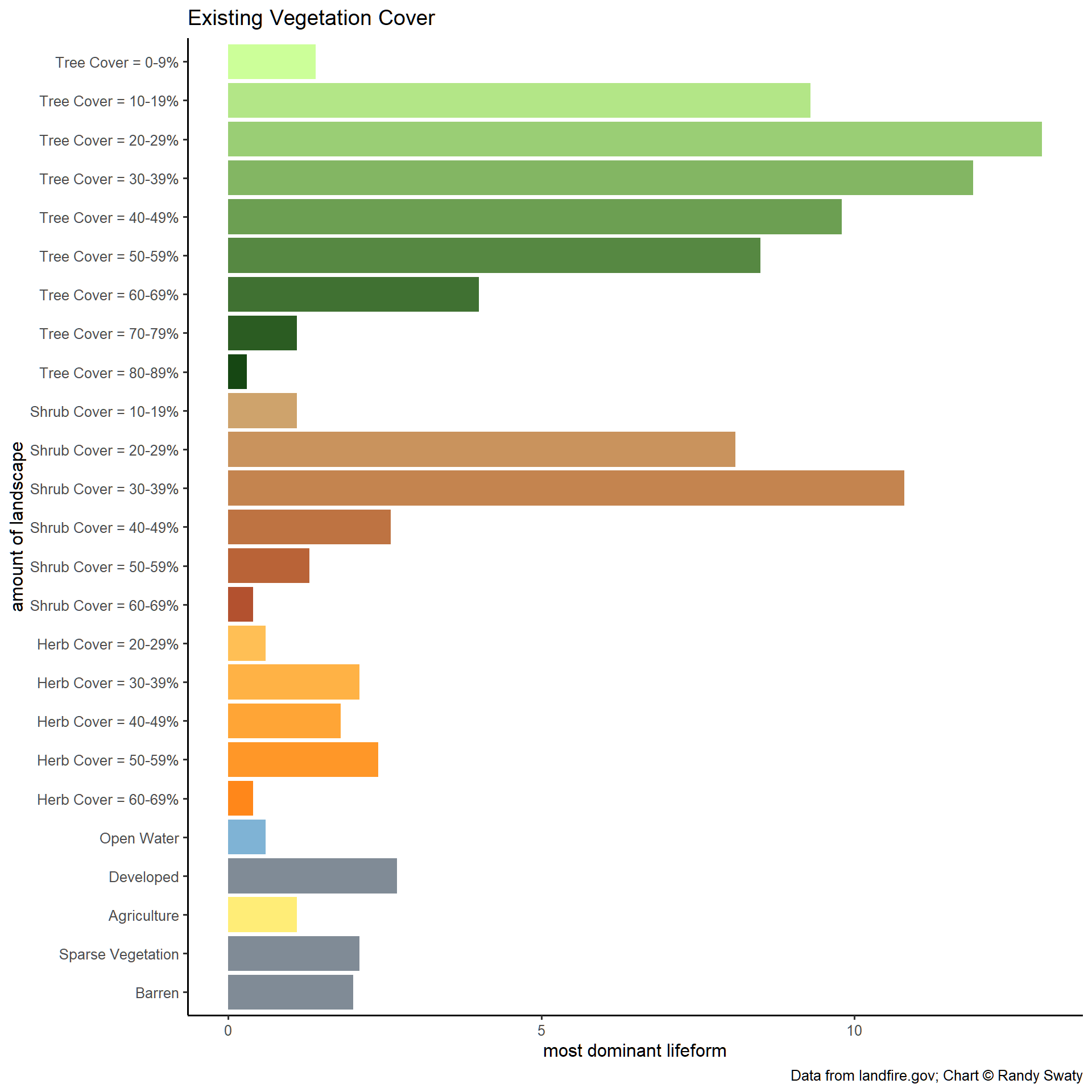
Existing Vegetation Cover
The Existing Vegetation Cover (EVC) map is a visual representation of EVC classifications across the subregion. The chart below the map provides a breakdown of each vegetation cover classification and their relative dominance across the subregion
From this information, we can see that the majority of this subregion is classified as “tree” comprising approximately 60% of the vegetation cover.
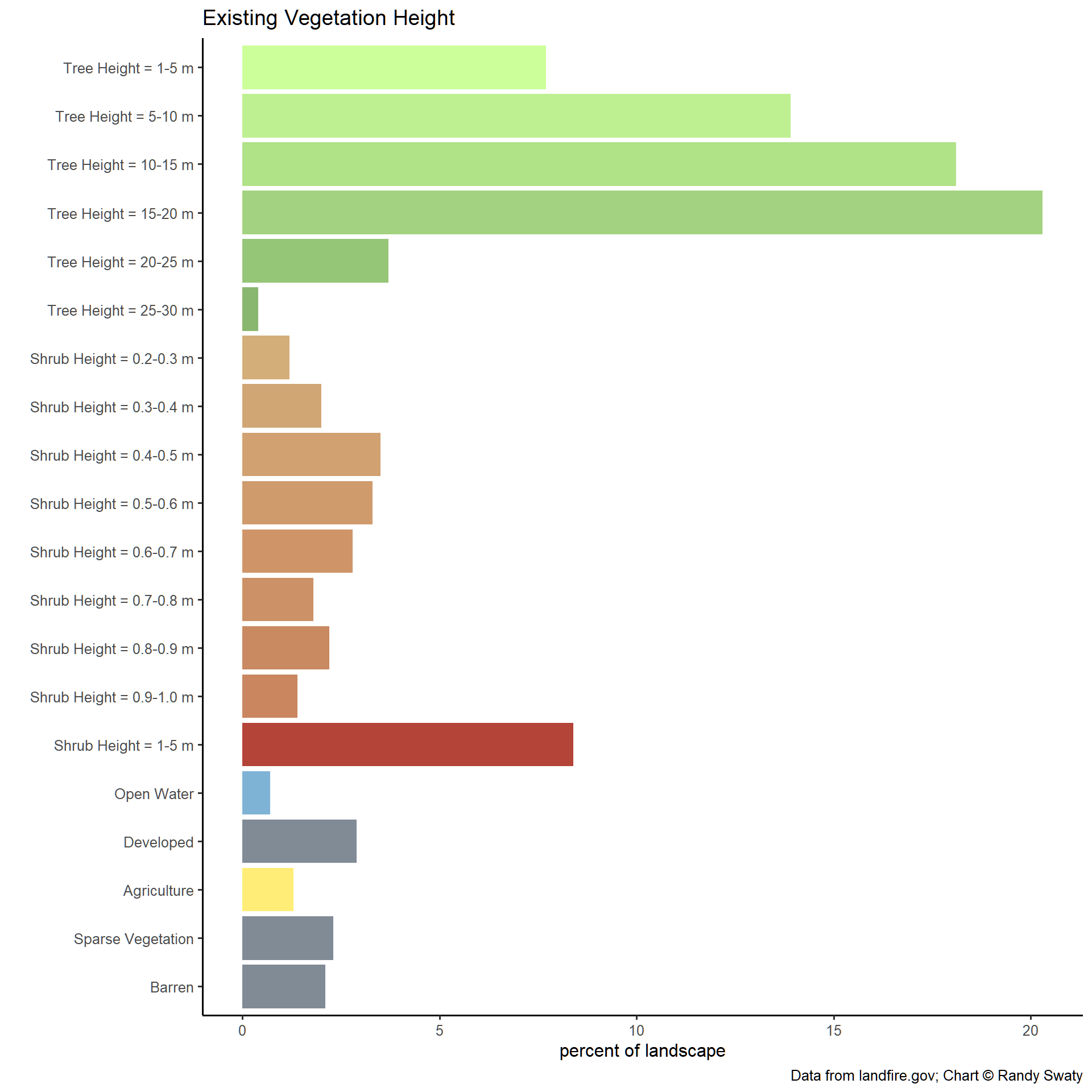
Existing Vegetation Height
The Existing Vegetation Height (EVH) map showcases EVH across the subregion. The chart below the map provides the percentage of the landscape represented by each EVH height.
From these results, most trees are between 1 - 20m tall and most shrubs are between 1 - 5m tall.