2 Ataya Intro
Introducing Ataya
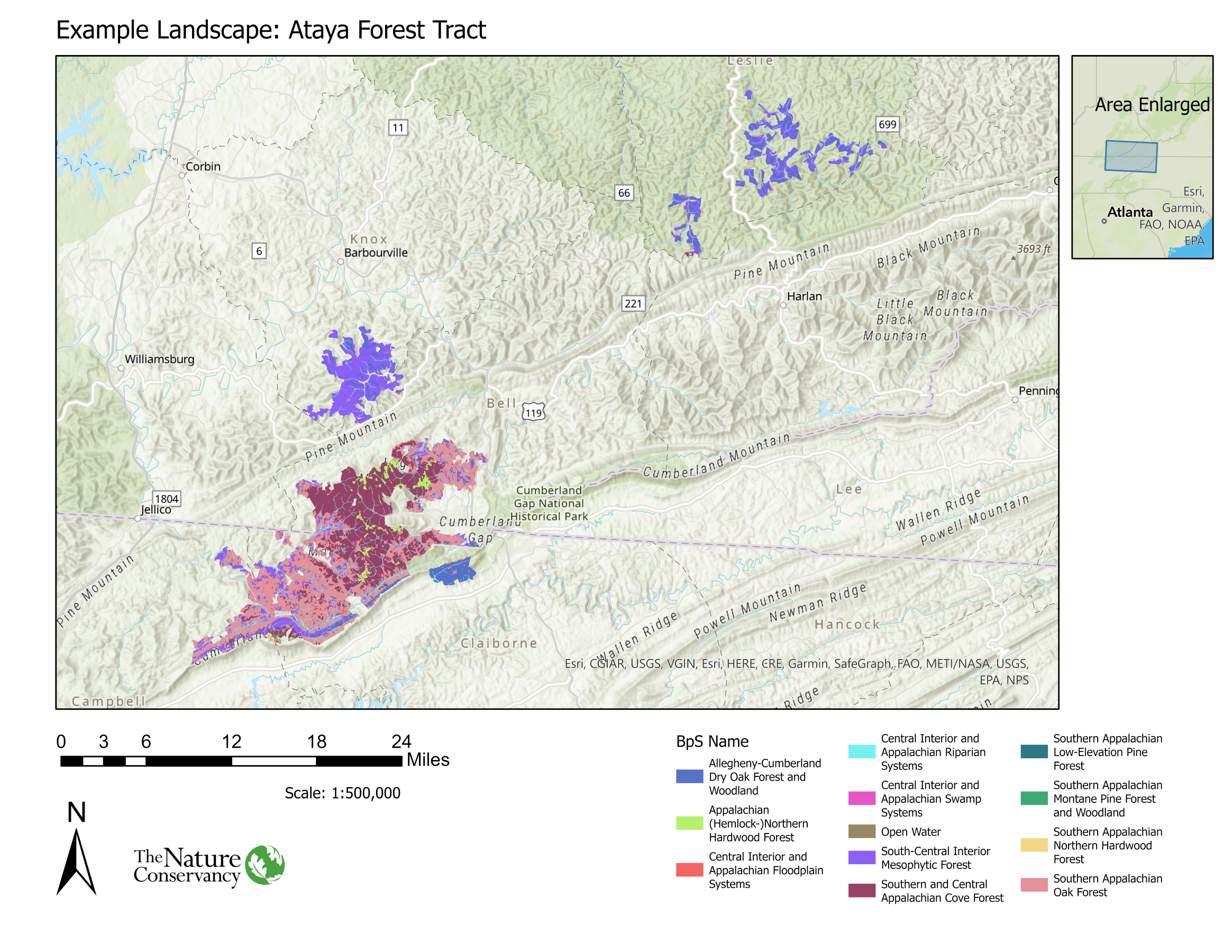
Ataya is an approximately 100,688-acre forested landscape in southeastern Kentucky and northeastern Tennessee. Ataya is located in Central Appalachia, and is situated in the historic territories of the S’atsoyaha (Yuchi), Shawandasse Tula (Shawnee), and the Tsalaguwetiyi (Cherokee, East) nations. You can explore these territorial claims here: (https://native-land.ca/). The largest nearby metropolitan area to Ataya is Knoxville, TN (population 186,173).
Historically, the landscape encompassing Ataya was oak-dominated forests, interspersed with mesophytic forest types in low elevation ravines. In these southern Appalachian oak forests, low severity surface fires with fire intervals of 7-26 years were a dominant disturbance, as well as insect outbreaks, ice storms, windthrow, and drought.
The forests in Central Appalachia experienced considerable alteration from European colonization and land use changes. Important land use and ecological changes included extensive clear-cut logging in the early 20th century, coal mining, the functional extinction of the American chestnut (Castanea dentata) and fire-suppression policies enacted in the early 20th century. Currently, Central Appalachia is facing population reductions in fire tolerant/shade intolerant species such as oaks (Quercus sp.) and shortleaf pine (Pinus echinata). Drastic population declines are also evident in eastern hemlock (Tsuga canadensis) due to the introduction of Hemlock Wooly Adelgid. Lastly, various invasive plants (i.e. kudzu, autumn olive, Japanese stilt grass) are also significant threats to Central Appalachian forest biodiversity and resiliency.
Ataya is of conservation interest due to the relatively high connectivity, large average land parcel size and projected climate change resiliency.